Aceguá, Brazil
Digital Passport
Nomenclature and Geography
Category: City / Municipality
Summary
About the place: Aceguá is a border town and municipality located in the southern part of the state of Rio Grande do Sul, Brazil, right on the border with Uruguay. The area is known primarily for its agricultural and livestock farming tradition in the pampa region.
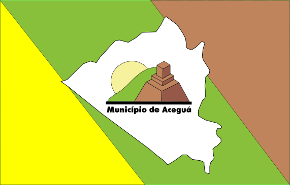
Flag Description: The flag consists of three diagonal bands running from the top left to the bottom right: yellow at the hoist side, green in the middle, and brown at the fly side. In the center of the flag is a white silhouette representing the geographical map outline of the municipality of Aceguá. Inside this white map outline is an emblem featuring a green hill with a yellow sun in the background and a brown monument or structure in the foreground. Below this scene, on a black base, is the inscription 'Município de Aceguá'.
Symbolism: The green and yellow colors represent the Brazilian national colors and the natural wealth of the region, while the brown color symbolizes the land and agricultural tradition. The white shape depicts the geographical contours of the municipality, and the central scene features the local landscape, the Cerro de Aceguá monument, and the municipality's name.
Statistics
Area
1,549.40 km²
Population
4,170