Altamira, Pará
Digital Passport
Nomenclature and Geography
Category: City / Municipality
Summary
About the place: Altamira is a vast municipality located in the state of Pará in northern Brazil. Covering an area of over 159,000 km², it is one of the largest municipalities in the world by land area.
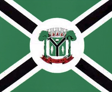
Flag Description: The flag consists of a green field divided by a diagonal black Saltire (St. Andrew's cross) bordered on both sides by white stripes. In the center of the flag is a white circular disc bearing the municipal coat of arms of Altamira, which features a shield, a mural crown, two trees as supporters, and a red ribbon with the text ALTAMIRA.
Symbolism: The green color symbolizes the lush nature and forests of the Amazon region. The diagonal saltire represents the riverways and roads connecting the region. The white central disc stands for peace and unity within the municipality, while the coat of arms displays the history, geographical location, and forestry heritage of Altamira.
Statistics
Area
159,533.30 km²
Population
126,279