Baturité
Digital Passport
Nomenclature and Geography
Category: City / Municipality
Summary
About the place: Baturité is a municipality in the state of Ceará, Brazil. Located in the mountainous Maciço de Baturité region, it is known for its historic architecture and surrounding natural beauty.
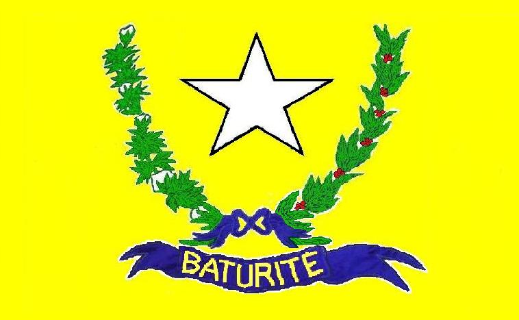
Flag Description: The flag consists of a yellow field centered with a white five-pointed star outlined in black. Below the star is a wreath composed of two green branches: a cotton branch with white bolls on the left side from the viewer's perspective and a coffee branch with red berries on the right. The branches are tied at the bottom with a blue bow, beneath which floats a wavy blue ribbon bearing the yellow inscription BATURITÉ.
Symbolism: The yellow color symbolizes the region's wealth and agricultural production. The white star represents freedom and peace. The green cotton and coffee branches refer to the traditional main agricultural crops that historically shaped the economy of Baturité. The blue ribbon bearing the name of the municipality clearly identifies the city.
Statistics
Area
308.80 km²
Population
35,218