Bělá pod Pradědem
Digital Passport
Nomenclature and Geography
Category: City / Municipality
Summary
About the place: Bělá pod Pradědem is a mountainous municipality in the Jeseník District of the Olomouc Region, stretching along the Bělá River in the Hrubý Jeseník mountain range. It serves as an important tourist hub and gateway for year-round recreation, hiking, and skiing in the areas around Mount Praděd and the Červenohorské sedlo pass.
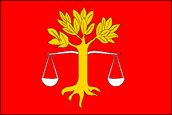
Flag Description: A red field charged with a yellow eradicated deciduous tree underlaid by a white balance scale. The aspect ratio is 2:3.
Symbolism: The red field recalls the historical affiliation with the Duchy of Nysa ruled by the Prince-Bishopric of Wrocław. The yellow (golden) eradicated tree is derived from the historic seal of the village of Domašov, representing the surrounding forests and forestry as the traditional source of livelihood. The white (silver) balance scale is taken from the historical seal of Adolfovice, symbolizing justice and harmony.
Flag Description: A red field charged with a yellow eradicated deciduous tree underlaid by a white balance scale. The aspect ratio is 2:3.
Symbolism: The red field recalls the historical affiliation with the Duchy of Nysa ruled by the Prince-Bishopric of Wrocław. The yellow (golden) eradicated tree is derived from the historic seal of the village of Domašov, representing the surrounding forests and forestry as the traditional source of livelihood. The white (silver) balance scale is taken from the historical seal of Adolfovice, symbolizing justice and harmony.
Statistics
Area
92.23 km²
Population
1,710