Bělá (Semily District)
Digital Passport
Nomenclature and Geography
Category: City / Municipality
Summary
About the place: Bělá is a municipality and village in Semily District, Liberec Region, situated in the picturesque Krkonoše foothills along the Oleška stream. It is a quiet rural community characterized by traditional architecture and a historical heritage of milling and weaving.
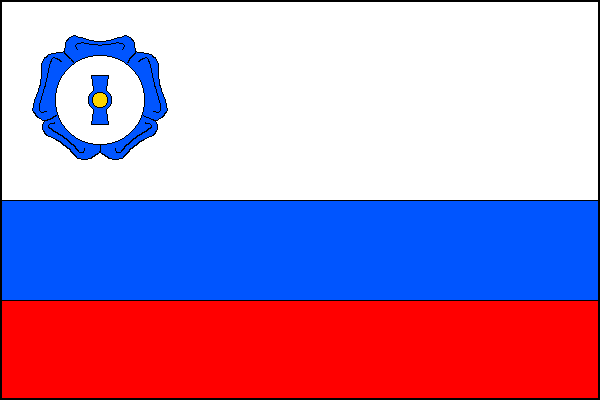
Flag Description: The flag consists of three horizontal stripes of white, blue, and red in a width ratio of 2:1:1. In the hoist part of the upper white stripe, a white millstone is superimposed on a blue flax flower. The ratio of the flag's width to length is 2:3.
Symbolism: The flax flower symbolizes the traditional cultivation of flax, home weaving, and textile crafts in the region. The millstone commemorates the historic milling heritage and local watermills. The white and blue colors reflect local streams and the place name Bělá (associated with white/clear water), while red completes the national colors and evokes the reddish local soil.
Statistics
Area
7.76 km²
Population
285