Belmonte, Santa Catarina
Digital Passport
Nomenclature and Geography
Category: City / Municipality
Summary
About the place: Belmonte is a municipality located in the western part of the state of Santa Catarina, Brazil. It is situated in a predominantly agricultural region near the border with Argentina.
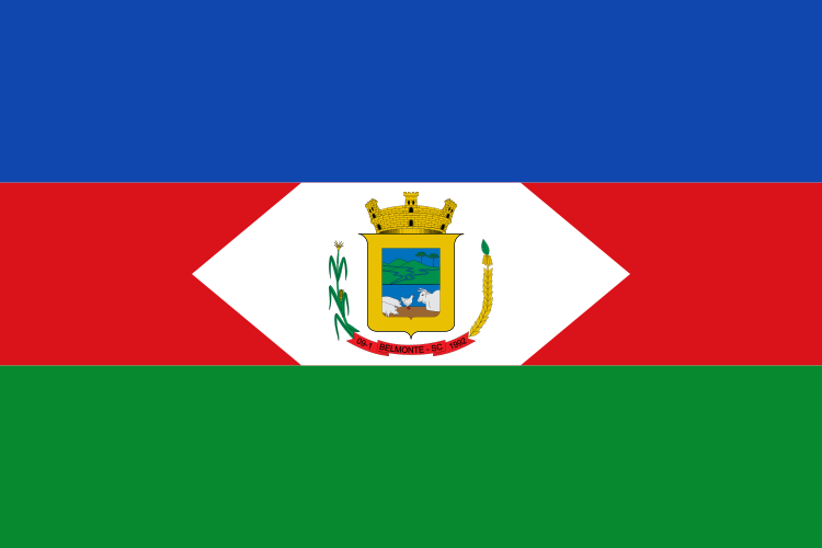
Flag Description: The flag consists of three horizontal bands of blue, red, and green. In the center, within the middle red stripe, is a white lozenge containing the municipal coat of arms. The coat of arms features a gold-bordered shield surmounted by a golden mural crown. Inside the shield is a landscape with hills, a river, and araucaria trees in the upper portion, and livestock in the lower portion. The shield is flanked by stalks of maize and wheat, with a red scroll at the bottom bearing the inscription '09-1 BELMONTE - SC 1992'.
Symbolism: The blue, red, and green colors symbolize the sky, courage or labor, and the natural wealth alongside agriculture. The white lozenge represents peace. The coat of arms depicts the local geography (hills, rivers), araucaria trees, livestock farming, and agricultural crops (maize, wheat), while the ribbon displays the municipality's name and founding date.
Statistics
Area
93.60 km²
Population
2,682