Běloky
Digital Passport
Nomenclature and Geography
Category: City / Municipality
Summary
About the place: Běloky is a small Central Bohemian municipality situated in the Zákolanský Stream valley in Kladno District, approximately 8 km east of Kladno and 15 km northwest of central Prague. It features a quiet rural atmosphere shaped by agricultural tradition and historical water mills dating back to the 13th century.
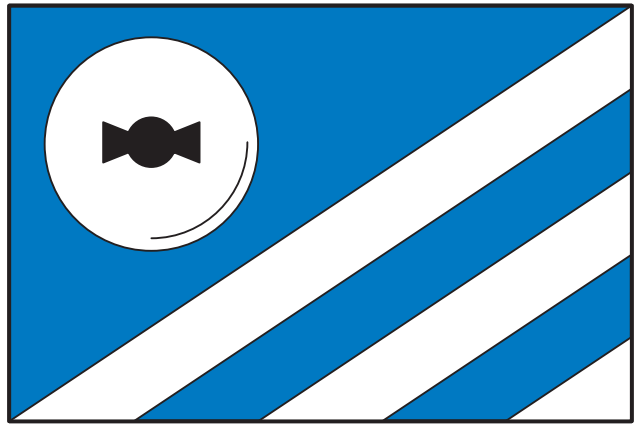
Flag Description: A flag divided diagonally per bend sinister from blue to white. In the upper blue field is a white millstone with a black millrind, and in the lower white field are two diagonal blue bends. The width-to-length ratio is 2 : 3.
Symbolism: The white (silver) millstone charged with a black millrind symbolizes the historical water mills and long-standing milling tradition of the municipality. The two diagonal blue bends and the azure field represent the Zákolanský Stream flowing through the area and water power as a vital historical resource. The combination of azure and silver also evokes the purity of local waters.
Statistics
Area
2.22 km²
Population
184