Bělov
Digital Passport
Nomenclature and Geography
Category: City / Municipality
Summary
About the place: Bělov is a small rural municipality in the western part of Zlín District, situated on the right bank of the Morava River between the Chřiby highlands and the Upper Morava Valley. It is also known for the Bělov weir on the Morava River.
Flag Description: Bělov is a municipality in the Zlín District in the Zlín Region of the Czech Republic, situated on the right bank of the Morava River at the foot of the Chřiby highlands, near Otrokovice and Kvasice.
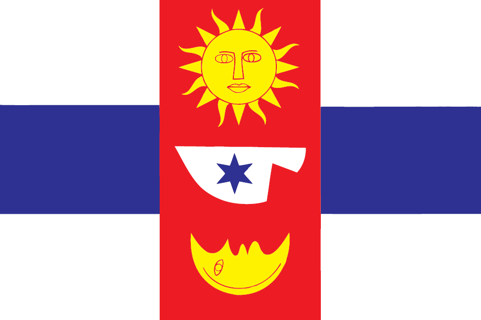
Symbolism: The red central vertical stripe bearing the sun, a ploughshare charged with a star, and a crescent moon reflects historical seal emblems and the village's agricultural roots. The alternating white and blue horizontal stripes represent the Morava River flowing past the municipality and its local importance (including the Bělov weir).
Statistics
Area
3.44 km²
Population
323