Bílá (Frýdek-Místek District)
Digital Passport
Nomenclature and Geography
Category: City / Municipality
Summary
About the place: The mountain municipality of Bílá is located in the Bílá Ostravice valley in the southern part of the Frýdek-Místek District, along the border with Slovakia. It is a well-known center for winter sports and summer outdoor tourism in the Moravian-Silesian Beskids.
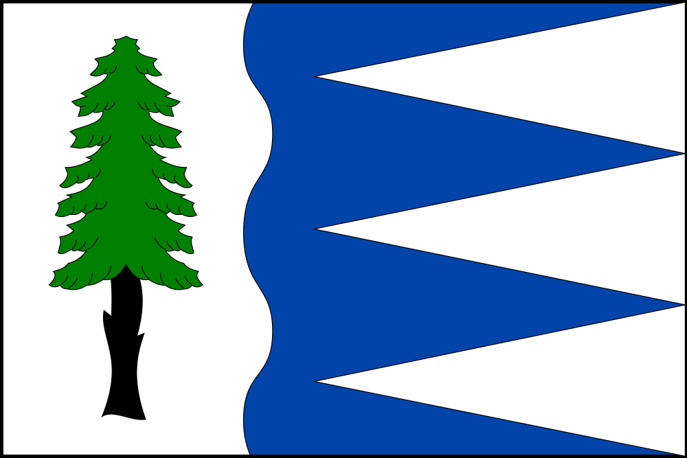
Flag Description: A blue flag with a wavy white hoist stripe occupying one-third of the flag's length, featuring two crests and three troughs. Three white piles issue from the fly edge with their apexes reaching the white hoist stripe. Charged in the white hoist stripe is a green spruce tree with a black trunk. The aspect ratio of width to length is 2:3.
Symbolism: The green spruce tree symbolizes the deep Beskid forests and traditional forestry. The wavy white stripe represents the Bílá Ostravice river and serves as a canting element referring to the municipality's name (Bílá = white). The three white piles in the blue field derive from the silver piles (cones) of the Olomouc Bishopric's coat of arms (former rulers of the Hukvaldy estate) while simultaneously evoking the mountain peaks of the Beskids.
Statistics
Area
56.45 km²
Population
284