Bílá (Liberec District)
Digital Passport
Nomenclature and Geography
Category: City / Municipality
Summary
About the place: Bílá is a rural municipality in the Liberec District of the Liberec Region, situated in the picturesque hilly landscape of the Ještěd foothills south of the Ještěd ridge. It comprises fourteen scattered villages and hamlets.
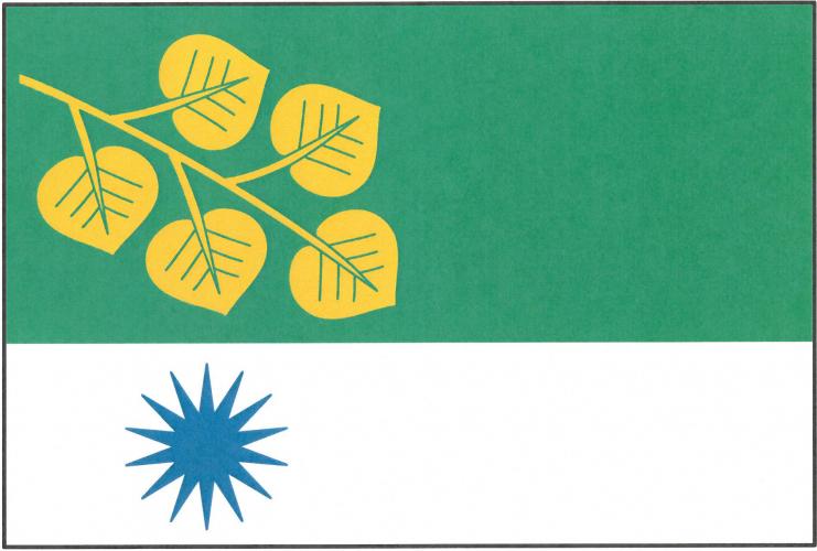
Flag Description: The flag consists of two horizontal stripes, green and white, in a width ratio of 5 : 3. In the hoist half of the flag, the green stripe bears a yellow linden branch with five leaves hanging bendwise, and directly below it in the white stripe is a blue fourteen-pointed star. The width-to-length ratio of the sheet is 2 : 3.
Symbolism: The municipal symbols were designed by heraldist Jan Tejkal and granted in March 2021. The green color reflects the rural character and landscape of the Ještěd foothills, while white (silver) serves as a canting element referencing the name Bílá (meaning 'white'). The linden branch with five leaves represents the five cadastral areas comprising the municipality, and the blue fourteen-pointed star stands for its fourteen administrative constituent hamlets and villages.
Statistics
Area
26.38 km²
Population
957