Blatnice (Třebíč District)
Digital Passport
Nomenclature and Geography
Category: City / Municipality
Summary
About the place: Blatnice is a rural municipality in the Třebíč District within the Vysočina Region of the Czech Republic, situated in the rolling landscape of the Jevišovice Uplands about 4 km southwest of Jaroměřice nad Rokytnou. It has a predominantly agricultural character and is drained by the Blatnický Stream.
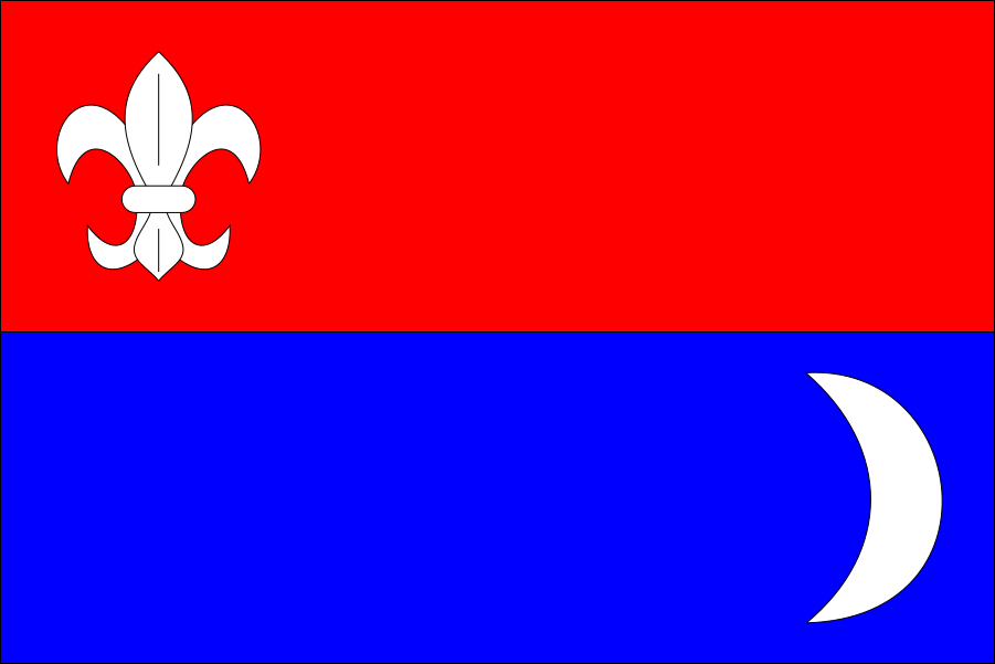
Flag Description: The flag consists of two horizontal stripes, red and blue. In the hoist portion of the red stripe is a white lily (fleur-de-lis), and in the fly portion of the blue stripe is a white crescent moon with horns pointing towards the hoist. The ratio of width to length is 2:3.
Symbolism: The flag simplifies elements from the municipal coat of arms granted in January 2007. The crescent and the fleur-de-lis refer to regional historical seals and former feudal lords who held the estate over the centuries (including the Lords of Lichtenburg, the Hodiický of Hodice, and the later estate of Jaroměřice nad Rokytnou). The white lily also represents purity and Marian symbolism, while red and blue correspond to the primary tincture fields of the municipal shield.
Statistics
Area
9.40 km²
Population
380