Břehov
Digital Passport
Nomenclature and Geography
Category: City / Municipality
Summary
About the place: Břehov is a South Bohemian municipality and village in České Budějovice District, situated in the pond-rich flat landscape of Zbudov Marshlands about 12 km northwest of České Budějovice. Its historic village core, renowned for vernacular South Bohemian folk Baroque architecture, is protected as a village heritage zone.
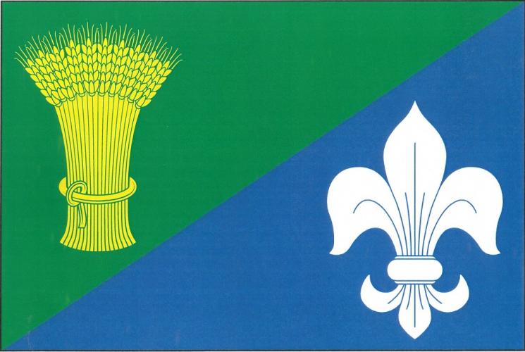
Flag Description: Per bend sinister vert and azure; in the upper green field a yellow wheatsheaf, in the lower blue field a white lily. The ratio of width to length is 2:3.
Symbolism: The diagonal division and blue field represent the local watercourses, ponds, and the municipality's geographic connection to water (the name stems from 'břeh', meaning bank or shore), while the green color and golden wheatsheaf signify agriculture, fertile soil, and rural heritage. The white lily serves as a traditional Marian symbol of purity and historical spiritual associations.
Flag Description: Per bend sinister vert and azure; in the upper green field a yellow wheatsheaf, in the lower blue field a white lily. The ratio of width to length is 2:3.
Symbolism: The diagonal division and blue field represent the local watercourses, ponds, and the municipality's geographic connection to water (the name stems from 'břeh', meaning bank or shore), while the green color and golden wheatsheaf signify agriculture, fertile soil, and rural heritage. The white lily serves as a traditional Marian symbol of purity and historical spiritual associations.
Statistics
Area
10.12 km²
Population
173