Bříství
Digital Passport
Nomenclature and Geography
Category: City / Municipality
Summary
About the place: Bříství is a small municipality situated in the Nymburk District of the Central Bohemian Region, in the Elbe lowland near the D11 motorway. It is known primarily for its early Gothic Church of the Finding of the Holy Cross and local fruit and vegetable farming traditions.
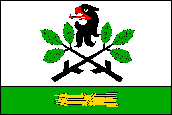
Flag Description: The flag consists of two horizontal stripes, white and green, in a width ratio of 3:1. The upper white stripe features two crossed black hackberry (nettle tree) branches, each with three green leaves and two knots, surmounted by a black eagle's head with a red beak and tongue. In the lower green stripe, there is a yellow bundle of arrows pointing toward the hoist. The width-to-length ratio is 2:3.
Symbolism: The crossed hackberry (elm) branches serve as a canting symbol referencing the village's etymology (derived from Old Czech 'břiestie', meaning an elm grove). The black eagle's head commemorates the historical feudal lords and nobility associated with the village's past. The golden bundle of arrows symbolizes unity, preparedness, and defense, while the green field and leaves reflect the fertile agricultural landscape of the Elbe lowlands.
Statistics
Area
3.60 km²
Population
396