Bukov
Digital Passport
Nomenclature and Geography
Category: City / Municipality
Summary
About the place: Bukov is a small rural municipality located in the Žďár nad Sázavou District within the Vysočina Region, set in the rolling hills of the Bohemian-Moravian Highlands about 11 km southeast of Nové Město na Moravě. It includes the hamlet of Dolní Bukov as well as the remnants of a namesake medieval castle.
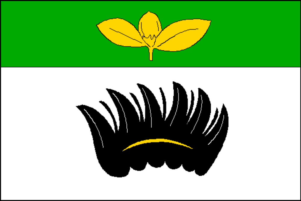
Flag Description: The flag consists of two horizontal stripes, green and white, in a width ratio of 1:2. The green stripe displays two yellow beech leaves with a beech nut, and the white stripe displays a black eagle wing charged with a yellow perizonium (crescent). The ratio of the flag's width to length is 2:3.
Symbolism: The yellow beech leaves with a beech nut in the green stripe are canting arms referencing the name of the municipality (Bukov, derived from 'buk' – beech tree) and the surrounding forested landscape of the Vysočina. The black eagle wing charged with a golden perizonium in the white stripe is derived from the coat of arms of the ancient Moravian noble lineage of Tasovci (Lords of Lomnice / Demeter of Bukov, documented in the 13th century), who established and owned the local medieval castle.
Flag Description: The flag consists of two horizontal stripes, green and white, in a width ratio of 1:2. The green stripe displays two yellow beech leaves with a beech nut, and the white stripe displays a black eagle wing charged with a yellow perizonium (crescent). The ratio of the flag's width to length is 2:3.
Symbolism: The yellow beech leaves with a beech nut in the green stripe are canting arms referencing the name of the municipality (Bukov, derived from 'buk' – beech tree) and the surrounding forested landscape of the Vysočina. The black eagle wing charged with a golden perizonium in the white stripe is derived from the coat of arms of the ancient Moravian noble lineage of Tasovci (Lords of Lomnice / Demeter of Bukov, documented in the 13th century), who established and owned the local medieval castle.
Statistics
Area
5.32 km²
Population
185