Bukovany (Sokolov District)
Digital Passport
Nomenclature and Geography
Category: City / Municipality
Summary
About the place: Bukovany is a municipality in the Sokolov District of the Karlovy Vary Region, situated in the Sokolov Basin west of Sokolov and northeast of Kynšperk nad Ohří. In modern history, its growth and character have been strongly tied to regional lignite mining.
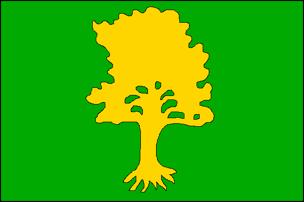
Flag Description: A green field with a yellow uprooted beech tree. The ratio of width to length is 2 : 3.
Symbolism: The uprooted beech tree on a green background serves as a canting symbol directly referencing the name Bukovany (derived from "buk", the Czech word for beech). The green color also represents the surrounding natural environment and forests.
Flag Description: A green field with a yellow uprooted beech tree. The ratio of width to length is 2 : 3.
Symbolism: The uprooted beech tree on a green background serves as a canting symbol directly referencing the name Bukovany (derived from "buk", the Czech word for beech). The green color also represents the surrounding natural environment and forests.
Statistics
Area
3.10 km²
Population
1,476