Bukovec (Frýdek-Místek District)
Digital Passport
Nomenclature and Geography
Category: City / Municipality
Summary
About the place: Bukovec is a picturesque foothill municipality in Frýdek-Místek District, Moravian-Silesian Region, nestled in the Jablunkov Intermontane near the Polish border. It is famously known as the easternmost municipality of the Czech Republic, encompassing the country's easternmost geographic point.
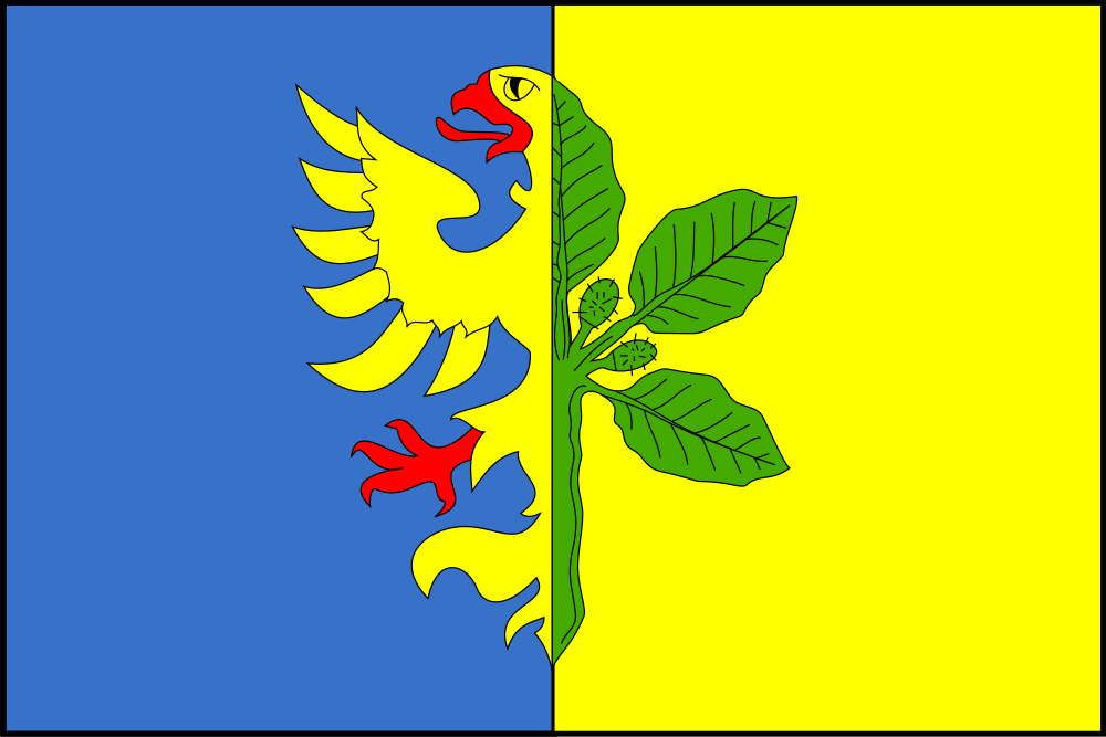
Flag Description: The flag consists of a blue hoist field and a yellow fly field. In the blue field is a dimidiated yellow eagle with red armature, joined with a dimidiated green beech branch bearing one half and two whole leaves in the yellow field. The width-to-length ratio is 2:3.
Symbolism: The half golden eagle on the blue field represents the historical ties to the Duchy of Cieszyn (Teschen) and Upper Silesia (the Cieszyn eagle). The beech branch serves as a canting symbol referencing the municipality's name (Bukovec, from 'buk' meaning beech) and its surrounding beech forests, while the green tincture denotes nature and the montane landscape of the Beskids.
Flag Description: The flag consists of a blue hoist field and a yellow fly field. In the blue field is a dimidiated yellow eagle with red armature, joined with a dimidiated green beech branch bearing one half and two whole leaves in the yellow field. The width-to-length ratio is 2:3.
Symbolism: The half golden eagle on the blue field represents the historical ties to the Duchy of Cieszyn (Teschen) and Upper Silesia (the Cieszyn eagle). The beech branch serves as a canting symbol referencing the municipality's name (Bukovec, from 'buk' meaning beech) and its surrounding beech forests, while the green tincture denotes nature and the montane landscape of the Beskids.
Statistics
Area
17.05 km²
Population
1,375