Bušín
Digital Passport
Nomenclature and Geography
Category: City / Municipality
Summary
About the place: Bušín is a submontane village and municipality in the Šumperk District of the Olomouc Region, situated along the Bušínský Brook at the border of the Hanušovice and Zábřeh Highlands. It lies approximately 11 kilometres west of Šumperk along the I/11 route connecting Bohemia and northern Moravia.
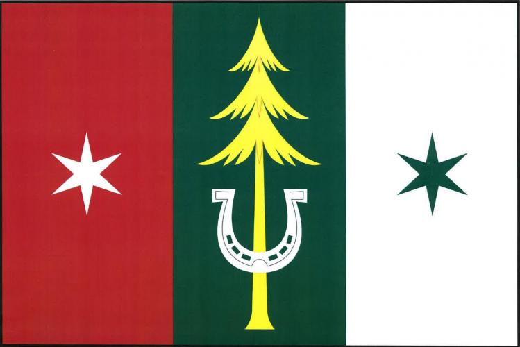
Flag Description: The flag consists of three vertical stripes of red, green, and white. In the green stripe is a yellow conifer tree, its trunk charged with an inverted white horseshoe. The red stripe features a white six-pointed star, and the white stripe features a green six-pointed star. The ratio of the flag's width to length is 2:3.
Symbolism: The coniferous tree and green colour symbolise the surrounding forested mountain slopes and the area's rich natural landscape. The inverted horseshoe represents historical transport and wagoner trade along the transit route through the valley, as well as rural crafts and agriculture. The six-pointed stars derive from the municipality's historical seal, which depicted a plowshare flanked by stars, while the red and white colours reflect traditional Moravian colours.
Flag Description: The flag consists of three vertical stripes of red, green, and white. In the green stripe is a yellow conifer tree, its trunk charged with an inverted white horseshoe. The red stripe features a white six-pointed star, and the white stripe features a green six-pointed star. The ratio of the flag's width to length is 2:3.
Symbolism: The coniferous tree and green colour symbolise the surrounding forested mountain slopes and the area's rich natural landscape. The inverted horseshoe represents historical transport and wagoner trade along the transit route through the valley, as well as rural crafts and agriculture. The six-pointed stars derive from the municipality's historical seal, which depicted a plowshare flanked by stars, while the red and white colours reflect traditional Moravian colours.
Statistics
Area
8.60 km²
Population
379