Caetés, Pernambuco
Digital Passport
Nomenclature and Geography
Category: City / Municipality
Summary
About the place: Caetés is a municipality in the state of Pernambuco, located in the Garanhuns microregion in Northeastern Brazil. It is widely known as the birthplace of former Brazilian President Luiz Inácio Lula da Silva.
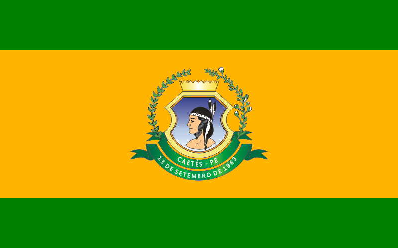
Flag Description: The flag consists of three horizontal bands: green, yellow (gold), and green, with the central yellow band being wider than the top and bottom green bands. In the center of the flag is the municipal coat of arms. The emblem features a shield with a light blue field depicting the profile of an Indigenous person's head (representing the Caeté people) facing left from the viewer's perspective. The shield is surmounted by a golden mural crown and flanked by two plant branches tied with a green ribbon at the bottom, bearing the white inscriptions 'CAETÉS - PE' and '13 DE SETEMBRO DE 1963'.
Symbolism: The green and yellow colors reflect Brazil's national colors, representing agricultural wealth and nature. The profile of the Indigenous head in the center directly references the native Caeté people, after whom the municipality is named. The golden crown represents municipal autonomy, while the green banner displays the municipality's name and the date of its official emancipation, September 13, 1963.
Statistics
Area
330.47 km²
Population
28,827