Cep (Jindřichův Hradec District)
Digital Passport
Nomenclature and Geography
Category: City / Municipality
Summary
About the place: Cep is a municipality and village in Jindřichův Hradec District in the South Bohemian Region of the Czech Republic, situated in the Třeboň Basin south of Třeboň. The surrounding area is characterized by dense pine forests and the traditional fishponds of the Třeboňsko Protected Landscape Area.
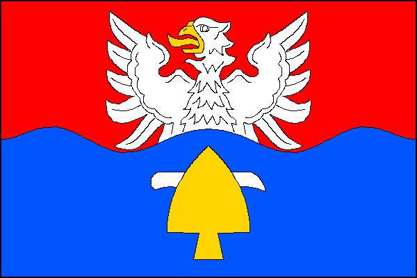
Flag Description: The flag consists of two horizontal stripes, red and wavy blue with three peaks and two troughs. Issuant into the red stripe is a white eagle with yellow armament; in the blue stripe is a frontal yellow ploughshare pointing upward, backed at the top by a white coulter with its cutting edge downward and point toward the fly. The ratio of width to length is 2:3.
Symbolism: The wavy partition and blue color symbolize the rich aquatic landscape of the Třeboň Basin, its fishponds, and the nearby Lužnice River. The issuant white eagle in the red field recalls historical noble rulers (such as the Krajíř of Krajk family and ties to the Třeboň estate), while the ploughshare and coulter represent agriculture, soil cultivation, and the village's rural heritage.
Statistics
Area
35.51 km²
Population
205