Chbany
Digital Passport
Nomenclature and Geography
Category: City / Municipality
Summary
About the place: Chbany is an agricultural municipality in Chomutov District, Ústí nad Labem Region, located in the rolling landscape of the Žatec Basin along the southern shore of the Nechranice Reservoir.
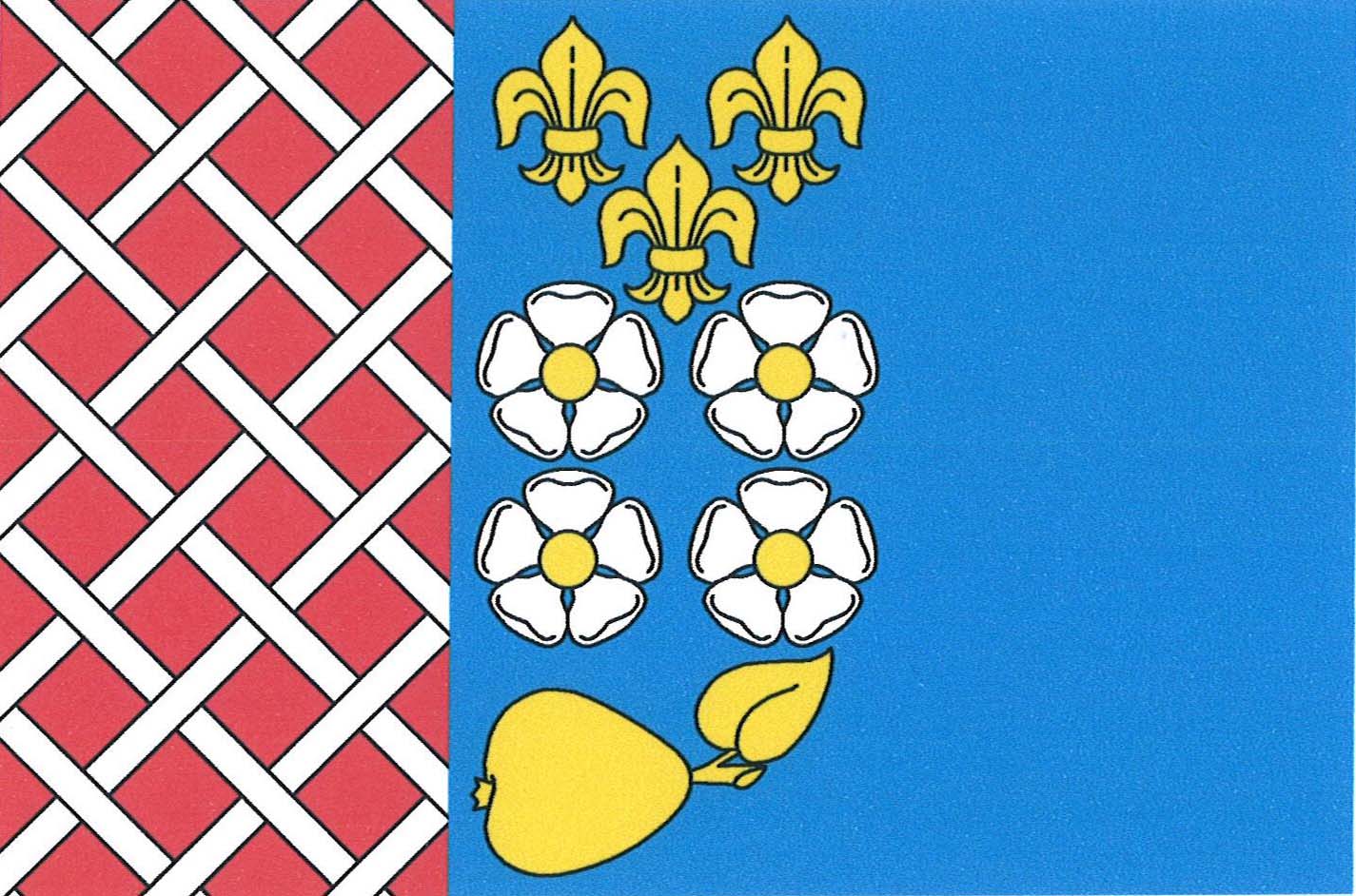
Flag Description: The flag consists of a red hoist stripe patterned with white interlaced fretty (lattice) occupying one-third of the flag's length, and a blue field. In the center of the flag are three (2, 1) yellow fleurs-de-lis above four (2, 2) white roses with yellow seeds, beneath which is a horizontally placed yellow pear with its leaf pointing toward the upper fly corner. The width-to-length ratio is 2:3.
Symbolism: The fretty latticework recalls the medieval ties to the Cistercian Abbey in Waldsassen and the Cheb/Eger region (giving the village its name). The fleurs-de-lis and roses represent Marian Cistercian devotion as well as former noble lords of the estate (notably the Lords of Fictum), while the golden pear reflects the regional fruit-growing tradition and fertility of the Ohře river basin. The blue field evokes the Ohře River and the nearby Nechranice Reservoir.
Statistics
Area
27.88 km²
Population
632