Chlístov (Rychnov nad Kněžnou District)
Digital Passport
Nomenclature and Geography
Category: City / Municipality
Summary
About the place: Chlístov is a small rural municipality in Rychnov nad Kněžnou District, located in the Hradec Králové Region of the Czech Republic, situated in the Orlické foothills near Dobruška. It lies in a scenic undulating landscape beneath the Orlické Mountains.
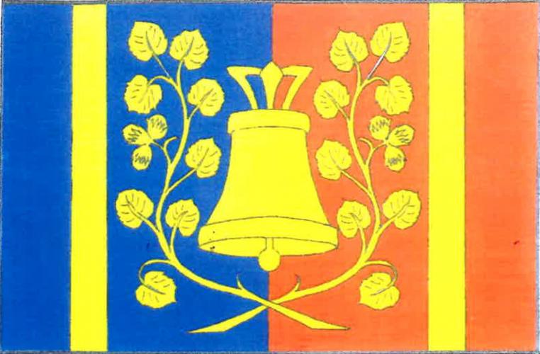
Flag Description: The flag consists of six vertical stripes: blue, yellow, blue, red, yellow, and red in proportions of 2:1:5:5:1:2. Centered across the inner blue and red stripes is a bell with a suspension loop flanked by two hazel branches crossed at the bottom, each bearing eight leaves and a cluster of three attached hazelnuts, all in yellow. The width-to-length ratio of the flag is 2:3.
Symbolism: The bell represents the historic local village belfry, a prominent cultural landmark of the municipality. The hazel branches with nuts form canting charges referring to the historical and traditional name of the village (Lískov, derived from hazel / líska). The blue and red field colors reflect the regional heritage and historical ties to the Opočno dominion, while yellow (gold) symbolizes bell bronze and agriculture.
Statistics
Area
1.38 km²
Population
75