Chlumany
Digital Passport
Nomenclature and Geography
Category: City / Municipality
Summary
About the place: Chlumany is a South Bohemian municipality situated in the Prachatice District within the Bohemian Forest foothills, about 2 km northwest of Vlachovo Březí. It features a peaceful rural character set in a scenic agricultural landscape.
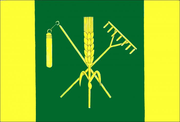
Flag Description: The flag consists of three vertical stripes of yellow, green, and yellow in a width ratio of 1:3:1. In the central green stripe is a yellow ear of grain with two leaves, underlaid by a bendwise sinister flail and a bendwise rake, both yellow. The width-to-length ratio of the sheet is 2:3.
Symbolism: The green color and yellow stripes symbolize the surrounding natural landscape, meadows, and forests of the Bohemian Forest foothills. The ear of grain accompanied by the crossed flail and rake represents the village's centuries-old agricultural heritage, harvesting, and traditional rural livelihoods.
Flag Description: The flag consists of three vertical stripes of yellow, green, and yellow in a width ratio of 1:3:1. In the central green stripe is a yellow ear of grain with two leaves, underlaid by a bendwise sinister flail and a bendwise rake, both yellow. The width-to-length ratio of the sheet is 2:3.
Symbolism: The green color and yellow stripes symbolize the surrounding natural landscape, meadows, and forests of the Bohemian Forest foothills. The ear of grain accompanied by the crossed flail and rake represents the village's centuries-old agricultural heritage, harvesting, and traditional rural livelihoods.
Statistics
Area
5.57 km²
Population
373