Chodský Újezd
Digital Passport
Nomenclature and Geography
Category: City / Municipality
Summary
About the place: Chodský Újezd (known as Svatý Kříž until 1961, German: Heiligenkreuz) is an extensive border municipality located in the Tachov District within the Plzeň Region, situated in the foothills of the Upper Palatinate Forest (Český les) northwest of Tachov.
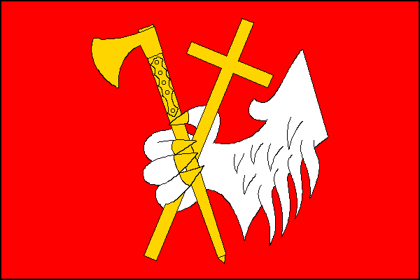
Flag Description: A red field with a centered white lion's paw armed yellow, holding a bendwise sinister yellow Chod axe (čakan) and a bendwise yellow Latin cross. The width-to-length ratio of the flag is 2:3.
Symbolism: The symbols reflect the local history: the Latin cross refers to the village's historical name Svatý Kříž (Heiligenkreuz) and the local Church of the Exaltation of the Holy Cross. The lion's paw and the traditional Chod walking axe (čakan) commemorate the historic role of the Chodové (Chods) who guarded the Bohemian borderlands. The red and white tincture also reflects the traditional colors of Bohemia.
Statistics
Area
64.74 km²
Population
834