Chotěvice
Digital Passport
Nomenclature and Geography
Category: City / Municipality
Summary
About the place: Chotěvice is a municipality in the Trutnov District in the Hradec Králové Region of the Czech Republic. It is situated in the valley of the Pilníkovský Stream near its confluence with the Elbe River, in the Giant Mountains foothills southwest of Trutnov.
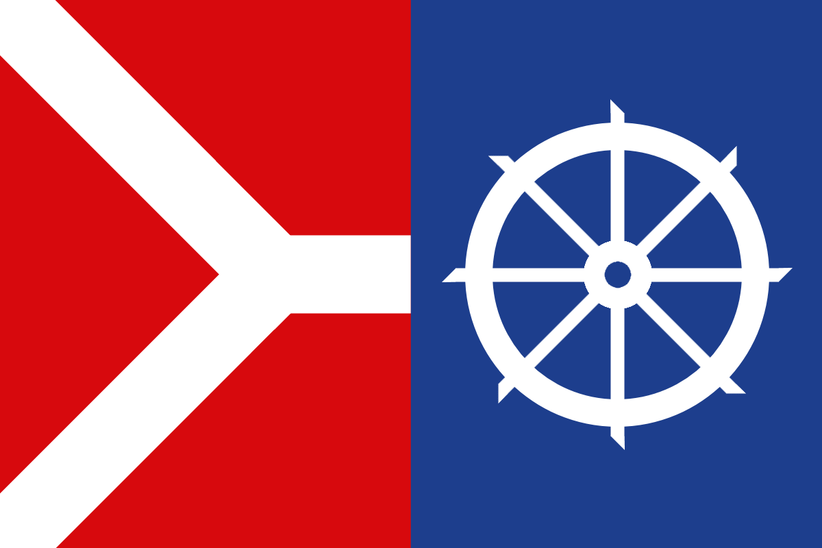
Flag Description: The flag consists of a red hoist section featuring a white fork and a blue fly section featuring a white Catherine wheel. The fork originates at the upper and lower fifths of the hoist edge, and its limbs are one-seventh of the flag's width wide. The width-to-length ratio is 2:3.
Symbolism: The white fork in the red field symbolizes the municipality's geographic location at the confluence of the Pilníkovský Stream and the Elbe River. The Saint Catherine's wheel in the blue field commemorates the vanished local village of Svatá Kateřina, which was historically connected to Chotěvice. The red and blue colors derive from the municipal coat of arms.
Statistics
Area
20.13 km²
Population
1,034