Choťovice
Digital Passport
Nomenclature and Geography
Category: City / Municipality
Summary
About the place: Choťovice is a small rural municipality situated in the northeastern part of the Kolín District in the Central Bohemian Region of the Czech Republic, located approximately 17 kilometers northeast of Kolín in the lowlands near the Žehuň Fishpond and Žiželice Forest.
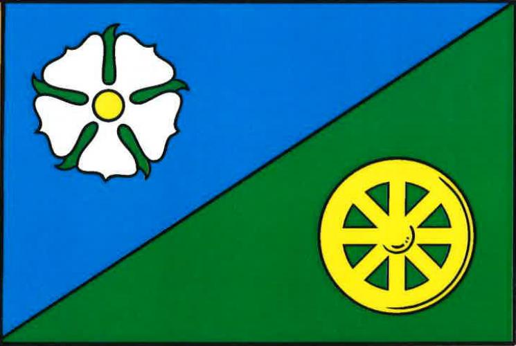
Flag Description: A flag divided diagonally from upper hoist to lower fly into blue and green. In the upper hoist blue field is a white rose with a yellow center and green sepals; in the lower fly green field is a yellow wagon wheel. The width-to-length ratio is 2:3.
Symbolism: The color division symbolizes the local landscape: blue represents the waters of the nearby Žehuň Fishpond, while green represents the surrounding forests and agricultural land. The diagonal division reflects the wavy partition line from the municipal coat of arms, evoking the elevation of the local medieval fort and prehistoric burial mounds. The white rose is a Marian attribute representing the local Church of the Nativity of the Virgin Mary, and the yellow spoked wheel commemorates the historic Libněves sugar beet narrow-gauge railway as well as local rural heritage.
Statistics
Area
9.06 km²
Population
255