Chudoslavice
Digital Passport
Nomenclature and Geography
Category: City / Municipality
Summary
About the place: Chudoslavice is a municipality and village in the Litoměřice District in the Ústí nad Labem Region of the Czech Republic, situated in the České středohoří Protected Landscape Area at the southern foot of the Trojhora hill about 7 km northeast of Litoměřice. The settlement has a traditional agricultural and fruit-growing character and consists of two parts: Chudoslavice and Myštice.
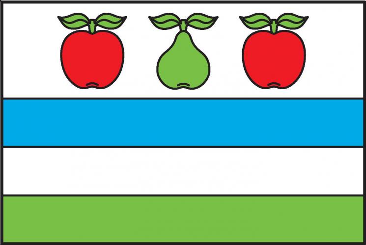
Flag Description: The flag consists of four horizontal stripes: white, blue, white, and green in a width ratio of 2 : 1 : 1 : 1. In the upper white stripe, there is a green pear between two red apples, all fruits having a stem with two green leaves. The ratio of the flag's width to its length is 2 : 3.
Symbolism: The municipal symbols, approved in 2018, reflect the local geography and historical economy. The apples and pear in the upper stripe symbolize the region's rich tradition of fruit growing and the surrounding orchards. The lower blue, white, and green stripes correspond to the municipal coat of arms, where the silver triple hill on a green base under a blue sky represents the distinctive local landmark – Mount Trojhora.
Flag Description: The flag consists of four horizontal stripes: white, blue, white, and green in a width ratio of 2 : 1 : 1 : 1. In the upper white stripe, there is a green pear between two red apples, all fruits having a stem with two green leaves. The ratio of the flag's width to its length is 2 : 3.
Symbolism: The municipal symbols, approved in 2018, reflect the local geography and historical economy. The apples and pear in the upper stripe symbolize the region's rich tradition of fruit growing and the surrounding orchards. The lower blue, white, and green stripes correspond to the municipal coat of arms, where the silver triple hill on a green base under a blue sky represents the distinctive local landmark – Mount Trojhora.
Statistics
Area
3.85 km²
Population
181