Chvalkovice (Náchod District)
Digital Passport
Nomenclature and Geography
Category: City / Municipality
Summary
About the place: Chvalkovice is a municipality in Náchod District, Hradec Králové Region, situated in an undulating landscape between the towns of Jaroměř and Česká Skalice. Comprising seven local parts, it features historical landmarks including a baroque chateau and the Church of Saint Giles.
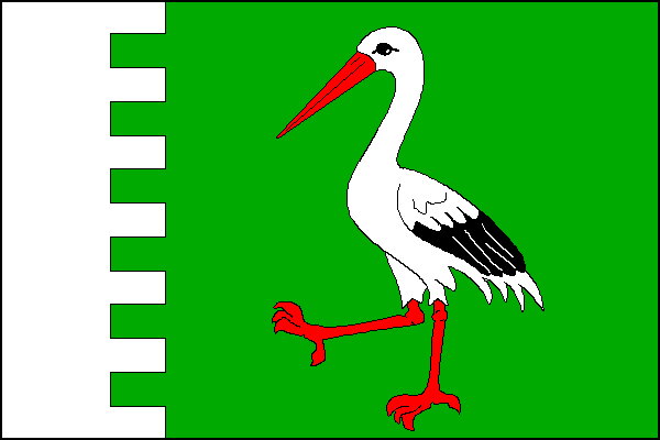
Flag Description: Chvalkovice is a municipality in the Hradec Králové Region of the Náchod District, situated in rolling agricultural country between Jaroměř and Česká Skalice near the Rozkoš reservoir. Featuring a baroque chateau and a rich heritage, it is composed of seven administrative parts.
Symbolism: The walking stork in the green field is derived from the ancestral coat of arms of the ancient Bohemian noble family Dobřenský of Dobřenice (specifically its Chvalkovice branch). The embattled partition with six merlons and seven indentations reflects the embattled chief in the coat of arms and the historic fortified manor/chateau, while the seven gaps correspond to the municipality's seven constituent villages. The green color represents agriculture, rural landscape, and nature.
Statistics
Area
12.30 km²
Population
809