Concordia, Entre Ríos
Digital Passport
Nomenclature and Geography
Category: City / Municipality
Summary
About the place: Concordia (officially San Antonio de Padua de la Concordia) is a prominent city in the Entre Ríos Province of Argentina, situated on the right bank of the Uruguay River directly opposite Salto, Uruguay. It serves as a major economic and agricultural hub for Argentine Mesopotamia, renowned for citrus production, forestry, and the nearby Salto Grande binational hydroelectric dam.
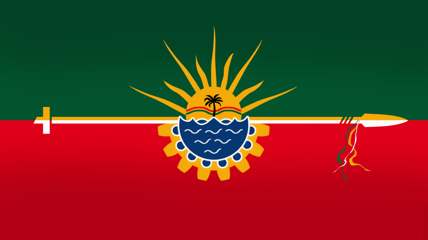
Flag Description: The flag is horizontally divided into two main fields: green on top and red at the bottom. The two halves are separated by a central horizontal stripe divided longitudinally into white (silver) and yellow (gold). This central dividing charge originates from the hoist as a Latin cross and extends toward the fly ending as a traditional tacuara lance point with red bindings. In the center sits a circular emblem bounded by a cogwheel, depicting the rolling hills of Cuchilla de Montiel along the Uruguay River, a yatay palm tree, and a golden rising sun. The flag's aspect ratio is 1:2 (commonly also manufactured in 2:3).
Symbolism: Green and red represent the traditional provincial colors found in the coat of arms of Entre Ríos. The cross near the hoist honors the region's Jesuit missionary heritage and early foundation, while the tacuara lance with red ties symbolizes Argentine federalism and the gaucho cavalry struggles during the independence era. The central emblem illustrates the Uruguay River, the rolling Cuchilla de Montiel landscape, and the native yatay palm (reviving the original municipal arms destroyed in a historic fire); the cogwheel represents industry, technical progress, and the Salto Grande hydroelectric plant, beneath a rising sun symbolizing liberty, truth, and dawn of a prosperous future.
Statistics
Area
255.00 km²
Population
179,203