Cotkytle
Digital Passport
Nomenclature and Geography
Category: City / Municipality
Summary
About the place: Cotkytle is a sub-mountain municipality in the Ústí nad Orlicí District, Pardubice Region, situated in the Zábřeh Highlands near the historical border between Bohemia and Moravia. Comprising four parts (Cotkytle, Herbortice, Janoušov, and Mezilesí), it features a picturesque undulating landscape dominated by forests and meadows.
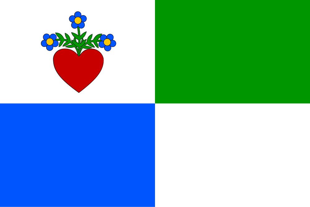
Flag Description: Quartered flag with an aspect ratio of 2:3. The upper hoist canton is white with a red heart from which issue three green stems, each bearing a blue blossom with a yellow centre. The lower hoist field is blue, the upper fly field is green, and the lower fly field is white.
Symbolism: The quartering of the flag symbolises the union of the four constituent parts of the municipality (Cotkytle, Herbortice, Janoušov, and Mezilesí). The white upper hoist field with the blossoming heart is derived directly from Cotkytle’s historical seal of 1749. The remaining three solid-colour fields represent the other three constituent villages and their respective tinctures in the coat of arms.
Flag Description: Quartered flag with an aspect ratio of 2:3. The upper hoist canton is white with a red heart from which issue three green stems, each bearing a blue blossom with a yellow centre. The lower hoist field is blue, the upper fly field is green, and the lower fly field is white.
Symbolism: The quartering of the flag symbolises the union of the four constituent parts of the municipality (Cotkytle, Herbortice, Janoušov, and Mezilesí). The white upper hoist field with the blossoming heart is derived directly from Cotkytle’s historical seal of 1749. The remaining three solid-colour fields represent the other three constituent villages and their respective tinctures in the coat of arms.
Statistics
Area
18.64 km²
Population
391