Ctiboř (Tachov District)
Digital Passport
Nomenclature and Geography
Category: City / Municipality
Summary
About the place: The municipality of Ctiboř is located in Tachov District, Plzeň Region, approximately 3 km northwest of Tachov on the margins of the Bohemian Forest. It is a quiet rural municipality dating back to the 14th century.
Flag Description: Ctiboř is a municipality in the Tachov District of the Plzeň Region in the Czech Republic, situated approximately 3 km northwest of Tachov. It lies on a rise at an elevation of about 595 metres on the border between the Bohemian Forest (Český les) and the Upper Palatine Forest Foothills.
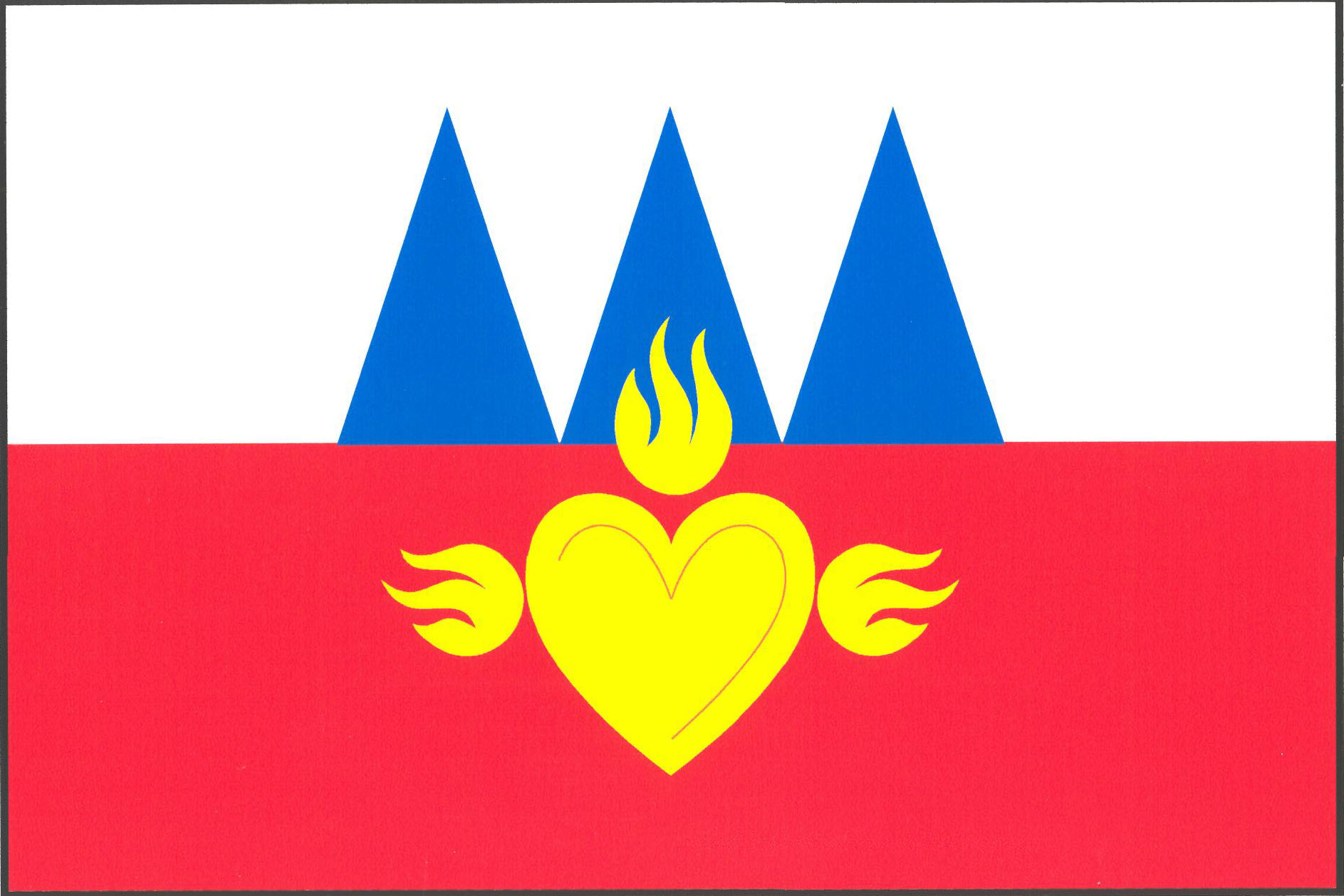
Symbolism: The flag is derived from the municipal coat of arms granted in 2007. The golden (yellow) heart flaming with three flames refers to the Chapel of the Sacred Heart of Jesus, a prominent local landmark from the 1920s. The three blue triangles correspond to the blue piles/wedges in the embattled wall of the municipal coat of arms, commemorating the historic 14th-to-16th-century fortress and the noble families who once held the manor.
Flag Description: Ctiboř is a municipality in the Tachov District of the Plzeň Region in the Czech Republic, situated approximately 3 km northwest of Tachov. It lies on a rise at an elevation of about 595 metres on the border between the Bohemian Forest (Český les) and the Upper Palatine Forest Foothills.
Symbolism: The flag is derived from the municipal coat of arms granted in 2007. The golden (yellow) heart flaming with three flames refers to the Chapel of the Sacred Heart of Jesus, a prominent local landmark from the 1920s. The three blue triangles correspond to the blue piles/wedges in the embattled wall of the municipal coat of arms, commemorating the historic 14th-to-16th-century fortress and the noble families who once held the manor.
Statistics
Area
9.43 km²
Population
324