Damníkov
Digital Passport
Nomenclature and Geography
Category: City / Municipality
Summary
About the place: Damníkov is a municipality in the Pardubice Region, Ústí nad Orlicí District, situated along the Lukovský Stream in the foothills of the Orlické Mountains about 7 km southwest of Lanškroun. It is a traditional linear forest-village (Waldhufendorf) dominated by the Neo-Gothic Church of the Nativity of Saint John the Baptist.
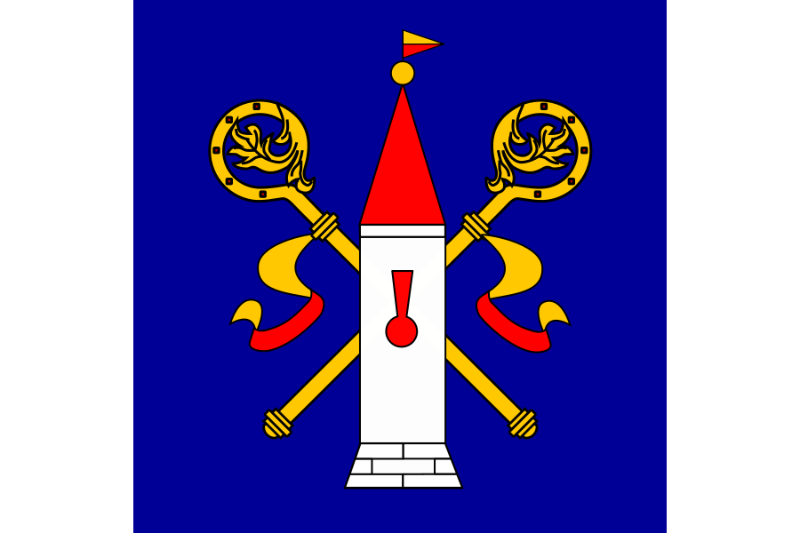
Flag Description: A flag of three vertical stripes of white, blue, and white in a width ratio of 1 : 4 : 1. In the central blue stripe, a white ashlar tower with a red keyhole-shaped loophole on a plinth, topped by a red pyramidal roof with a yellow finial and a yellow-over-red divided pennant. The base of the tower is underlaid by two crossed inward-turned yellow crosiers with yellow and red sudaria. The ratio of width to length is 2 : 3.
Symbolism: The tower with a loophole represents the original medieval fortified church that served as a defensive refuge for villagers during troubled times. The crossed pastoral staffs (crosiers) with sudaria symbolize the historical ecclesiastical ties of the village to the Diocese of Litomyšl and medieval monastic administration established after 1358. Blue and white/silver represent the heraldic colours of the region's historical heritage.
Statistics
Area
12.72 km²
Population
698