De Panne
Digital Passport
Nomenclature and Geography
Category: City / Municipality
Summary
About the place: De Panne is the southernmost coastal municipality in the Belgian province of West Flanders, located right on the border with France. It is renowned for its wide sandy beaches, extensive dune reserves, and vibrant seaside tourism.
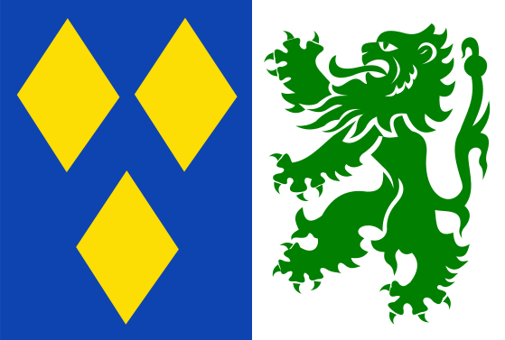
Flag Description: The flag is vertically divided into two halves. The hoist (left) half is blue, charged with three yellow lozenges (two placed side by side at the top, one centered below). The fly (right) half is white, featuring a large green rampant lion facing the hoist.
Symbolism: The flag combines elements from the historical coats of arms of the estates and former municipalities in the region. The blue field with three yellow lozenges originates from the arms of Veurne-Ambacht / Adinkerke, while the green lion on a white field represents the historical estate of Sint-Winoksbergen (Bergues).
Statistics
Area
23.90 km²
Population
11,129