Dětmarovice
Digital Passport
Nomenclature and Geography
Category: City / Municipality
Summary
About the place: Dětmarovice is a municipality in the Moravian-Silesian Region (Karviná District) located in the Ostrava Basin along the Olza River near the Polish border. The village is widely known for hosting the prominent Dětmarovice Power Station.
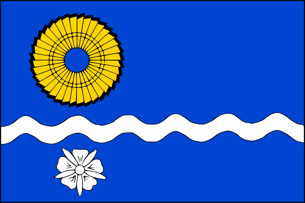
Flag Description: A blue field with a white wavy horizontal stripe featuring six crests and five troughs, one-tenth of the flag width wide and situated six-tenths from the top edge. In the upper fly corner is a yellow turbine runner, and in the lower fly corner is a white corn-cockle flower. The flag ratio is 2:3.
Symbolism: The yellow turbine runner represents the modern identity and industrial prominence of the municipality, home to the Dětmarovice Power Station. The white corn-cockle flower is canting heraldry referencing the integrated village of Koukolná (from Czech 'koukol'). The wavy white stripe depicts the Olza River flowing through the area. The combination of blue and yellow reflects historical ties to the Duchy of Teschen, while the simultaneous use of gold and silver symbolizes the unity of two historic communities (Dětmarovice and Koukolná).
Statistics
Area
13.76 km²
Population
4,435