Dobročkovice
Digital Passport
Nomenclature and Geography
Category: City / Municipality
Summary
About the place: Dobročkovice is a municipality in the Vyškov District of the South Moravian Region, situated in the rolling landscape of the Litenčice Hills roughly 7 km southeast of Bučovice. It is a traditional rural agricultural settlement dominated by the parish Church of All Saints.
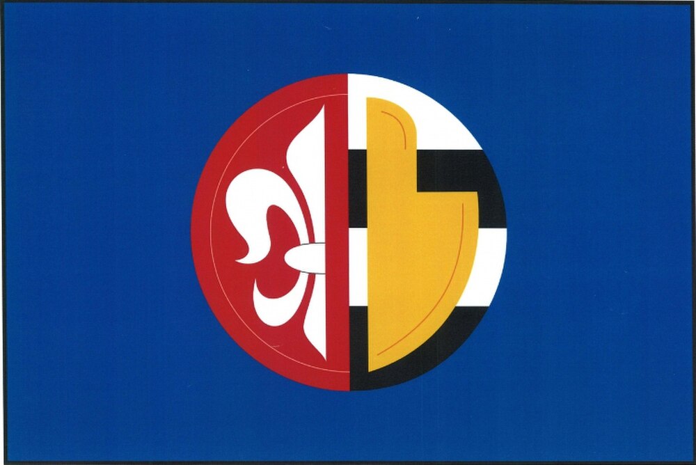
Flag Description: A blue field with a split roundel in the center; the hoist half is red featuring half of a white fleur-de-lis, and the fly half consists of four horizontal stripes, alternating white and black, surcharged with a yellow ploughshare pointing downwards and with its blade turned towards the hoist. The ratio of width to length is 2:3.
Symbolism: The half white fleur-de-lis on a red field refers to the coat of arms of the noble House of Zástřizl (who bore a silver fleur-de-lis in a red shield), owners of the village throughout the 15th century. The yellow ploughshare is derived from the historic municipal seal and signifies the village's agricultural heritage and rural labour. The alternating white and black stripes and the blue field complete the vexillological composition adapted from the municipal coat of arms.
Statistics
Area
5.03 km²
Population
232