Dolní Dunajovice
Digital Passport
Nomenclature and Geography
Category: City / Municipality
Summary
About the place: Dolní Dunajovice is a traditional wine-producing municipality in Břeclav District, South Moravian Region, situated beneath the Dunajovice Hills near the Nové Mlýny reservoirs and the Pálava Protected Landscape Area.
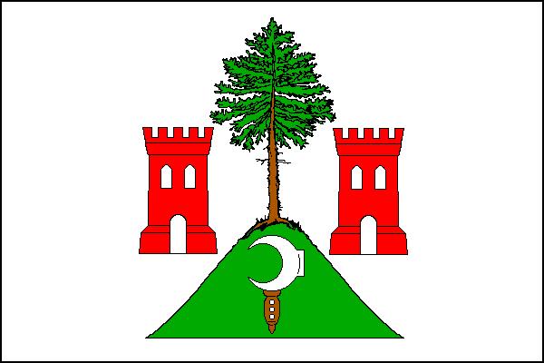
Flag Description: A white field, in the center a detached green hill bearing a green fir tree with a brown trunk between two red embattled towers, each with an open gate and two arched windows. Inside the hill, a white vine knife (billhook) with a brown handle. The ratio of the flag is 2:3.
Symbolism: The symbols derive from the civic arms granted on January 1, 1580, by Count Franz von Thurn and Valsassina upon promoting the settlement to a market town. The red embattled towers with gates symbolize market town status and civic rights, the green hill represents the local Dunajovice Hills landscape, and the vine knife (billhook) stands for the centuries-old winemaking heritage. The fir tree is a canting element referring to the historic German name of the municipality, Unter-Tannowitz.
Statistics
Area
17.87 km²
Population
1,715