Dolní Heřmanice
Digital Passport
Nomenclature and Geography
Category: City / Municipality
Summary
About the place: Dolní Heřmanice is a municipality in the Žďár nad Sázavou District in the Vysočina Region of the Czech Republic, situated in the Křižanov Highlands along the Oslava River, approximately 6 km east of Velké Meziříčí. It comprises two administrative parts: Dolní Heřmanice and Oslava.
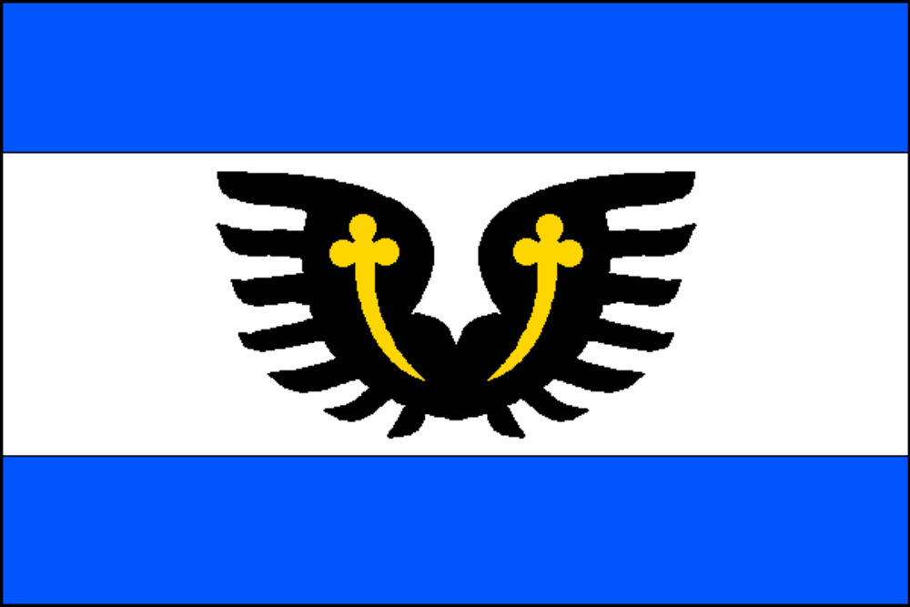
Flag Description: The flag consists of three horizontal stripes of blue, white, and blue in a width ratio of 1:2:1. In the centre of the white stripe are two conjoined black wings bound by a yellow ribbon (perizonium). The flag's aspect ratio is 2:3.
Symbolism: The conjoined black wings bound by a yellow ribbon (perizonium) on the white field derive from the coat of arms of the Lords of Lomnice (and their Tasov branch), who historically held the territory from the 14th century. The blue and white colors represent local waters, notably the Oslava River flowing through the municipality.
Statistics
Area
14.15 km²
Population
590