Dolní Kalná
Digital Passport
Nomenclature and Geography
Category: City / Municipality
Summary
About the place: Dolní Kalná is a rural municipality in the Trutnov District of the Hradec Králové Region, situated in the Giant Mountains foothills along the Kalenský Stream. It is characterized by its tranquil countryside setting and preserved regional folk and sacred architecture.
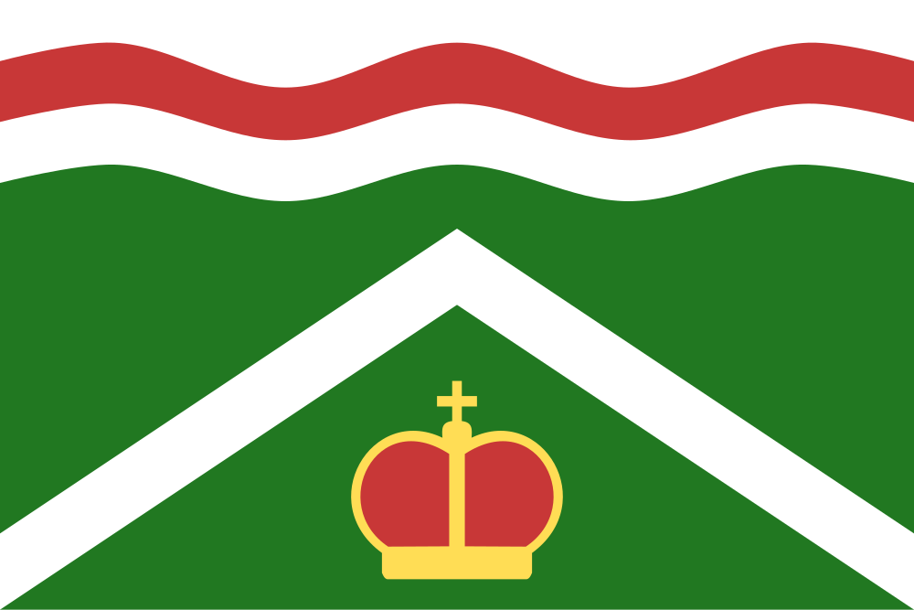
Flag Description: The flag consists of four horizontal stripes: white, wavy red, wavy white, and undulating green, in a width ratio of 1 : 1 : 1 : 7. The wavy stripes have three crests and two troughs. In the green stripe, a yellow princely crown is set beneath a white chevron issuing from the bottom eighth of the hoist and fly edges, with its apex at three-eighths of the flag width. The ratio of the flag width to length is 2 : 3.
Symbolism: The wavy stripes and the red tincture represent the Kalenský Stream, which flows through the village and gave it its name (referring to reddish murky water from the local Permian soil). The chevron signifies the foothill topography as well as historical local stone quarrying. The princely crown is a tribute to Saint Wenceslaus, the patron saint of the local parish church, and derives from the historical municipal seal. The green color represents surrounding nature, forests, and agriculture.
Statistics
Area
9.70 km²
Population
691