Dolní Nivy
Digital Passport
Nomenclature and Geography
Category: City / Municipality
Summary
About the place: Dolní Nivy (historically Untergrün) is a municipality in the Sokolov District of the Karlovy Vary Region, situated at the foothills of the Ore Mountains north of Sokolov. It features a rural, hilly landscape characterized by forests, meadows, and pastures.
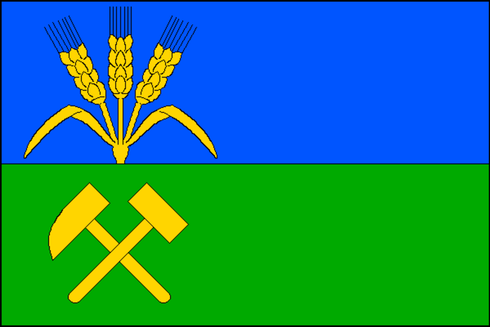
Flag Description: The flag consists of two horizontal stripes, blue and green. In the hoist half, three ears of grain joined at the base grow into the blue stripe, the outer ones divergent with leaves, below them in the green stripe are crossed mining hammers, all yellow. The hoist-to-fly ratio is 2:3.
Symbolism: The ears of grain and the green stripe symbolize agriculture and allude to the municipality's name (derived from the historic German name Grün, referring to cleared green meadowland or flats). The crossed mining hammers and the blue stripe commemorate the area's rich mining heritage (historic ore mining followed by brown coal extraction) and the local natural environment.
Statistics
Area
18.82 km²
Population
360