Dolní Rychnov
Digital Passport
Nomenclature and Geography
Category: City / Municipality
Summary
About the place: Dolní Rychnov is a municipality in the Sokolov District of the Karlovy Vary Region, situated directly south of the town of Sokolov in the Sokolov Basin. Originally an agricultural village, it became a major brown coal mining and industrial center during the 19th and 20th centuries.
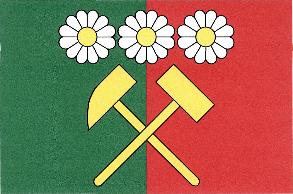
Flag Description: Vertically divided green and red. In the center are crossed yellow mining hammers, surmounted by three white flowers with yellow centers arranged side by side. The width-to-length ratio is 2:3.
Symbolism: The crossed mining hammers symbolize the rich heritage of lignite (brown coal) mining in the Sokolov Basin, which drove the area's development. The three white flowers represent the local natural environment, ecological recultivation, and the village's agricultural origins. The green and red field colors reflect the balance between nature and industrial heritage.
Flag Description: Vertically divided green and red. In the center are crossed yellow mining hammers, surmounted by three white flowers with yellow centers arranged side by side. The width-to-length ratio is 2:3.
Symbolism: The crossed mining hammers symbolize the rich heritage of lignite (brown coal) mining in the Sokolov Basin, which drove the area's development. The three white flowers represent the local natural environment, ecological recultivation, and the village's agricultural origins. The green and red field colors reflect the balance between nature and industrial heritage.
Statistics
Area
5.09 km²
Population
1,282