Dolní Těšice
Digital Passport
Nomenclature and Geography
Category: City / Municipality
Summary
About the place: Dolní Těšice is a small rural municipality in the Přerov District of the Olomouc Region, located in the Moravian Gate area southeast of Hranice. First mentioned in 1141 in a charter of Olomouc Bishop Jindřich Zdík, it maintains a quiet agricultural character.
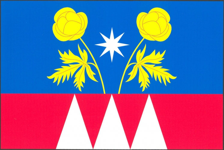
Flag Description: Dolní Těšice is a small municipality in the Přerov District of the Olomouc Region, situated in the gently rolling agricultural landscape of the Moravian Gate, approximately 7 km south of Hranice.
Symbolism: The blue and red colors, along with the three white piles (points), refer to the historical affiliation with the Bishopric of Olomouc (episcopal fief) and its heraldic colors and charges. The two yellow globeflowers represent the local natural environment and rare protected flora found within the municipality's territory. The white eight-pointed star is a traditional heraldic emblem symbolizing guidance, protection, and faith.
Statistics
Area
2.56 km²
Population
63