Dolní Tošanovice
Digital Passport
Nomenclature and Geography
Category: City / Municipality
Summary
About the place: Dolní Tošanovice is a municipality in the Frýdek-Místek District of the Moravian-Silesian Region in the Czech Republic, situated in the Podbeskydí Foothills roughly 10 km east of Frýdek-Místek. It features a dispersed rural settlement pattern set within the undulating agricultural landscape of historical Cieszyn Silesia.
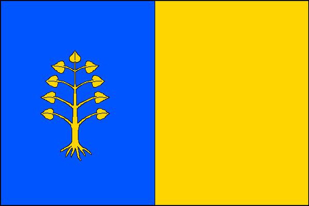
Flag Description: The flag is vertically divided into a blue hoist half and a yellow fly half. Charged in the blue hoist field is a yellow uprooted linden tree. The aspect ratio of the flag is 2:3.
Symbolism: The uprooted linden tree directly derives from the historical village seal of 1723, which featured a leafy tree; the exposed roots also signify the deep historical roots and continuity of the community dating back to 1305. The blue and yellow (gold) color scheme reflects the historical heraldic colors of the Duchy of Cieszyn (Upper Silesia).
Flag Description: The flag is vertically divided into a blue hoist half and a yellow fly half. Charged in the blue hoist field is a yellow uprooted linden tree. The aspect ratio of the flag is 2:3.
Symbolism: The uprooted linden tree directly derives from the historical village seal of 1723, which featured a leafy tree; the exposed roots also signify the deep historical roots and continuity of the community dating back to 1305. The blue and yellow (gold) color scheme reflects the historical heraldic colors of the Duchy of Cieszyn (Upper Silesia).
Statistics
Area
3.70 km²
Population
428