Dolní Třebonín
Digital Passport
Nomenclature and Geography
Category: City / Municipality
Summary
About the place: Dolní Třebonín is a South Bohemian municipality situated in the Český Krumlov District, roughly halfway between České Budějovice and Český Krumlov. It has a tranquil rural character set within a gently rolling agricultural landscape near the Vltava River valley.
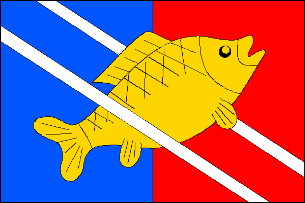
Flag Description: The flag consists of two vertical stripes of blue and red, and two diagonal white stripes (running from the upper hoist to the lower fly), each with a width of one-sixteenth of the hoist and spaced three-sixteenths of the hoist apart. Between the white stripes, overlying the upper and passing beneath the lower, a yellow carp swims diagonally toward the upper fly corner. The ratio of hoist to length is 2:3.
Symbolism: The yellow carp highlights the regional South Bohemian fishpond and aquaculture tradition as well as local watercourses (Třebonínský stream, Vltava River). Blue and red reflect the historical livery colors of prominent regional noble dynasties (the Rosenbergs and Schwarzenbergs), with blue also representing water. The white diagonal stripes correspond to the tines of the silver pitchfork taken from the municipal coat of arms, symbolizing the village's agricultural roots.
Statistics
Area
20.43 km²
Population
1,356