Dolní Věstonice
Digital Passport
Nomenclature and Geography
Category: City / Municipality
Summary
About the place: Dolní Věstonice is a winemaking municipality in the South Moravian Region, situated at the foot of the Pavlov Hills on the southern shore of the Nové Mlýny reservoirs along the Thaya River. It is world-renowned primarily as a major Upper Paleolithic archaeological site and the discovery place of the Venus of Dolní Věstonice.
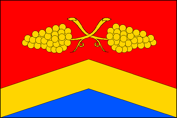
Flag Description: The flag is divided by a yellow chevron into an upper red and a lower blue field. The chevron originates from the lower fourth of the hoist and fly edges, with its apex at the centre of the field. In the red field are two yellow bunches of grapes placed horizontally back-to-back with crossed stems. The ratio of width to length is 2:3.
Symbolism: The yellow chevron and blue field vexillologically represent the wooden bridge and the Thaya River (historical river crossing and fishing), derived from the municipal coat of arms. The red field with two golden bunches of grapes with crossed stems symbolizes the centuries-old local tradition of viticulture and winemaking in the Pálava region.
Statistics
Area
8.82 km²
Population
308