Dolní Životice
Digital Passport
Nomenclature and Geography
Category: City / Municipality
Summary
About the place: Dolní Životice is a municipality located in the Moravian-Silesian Region within the Opava District, situated along the Hvozdnice stream approximately 11 km southwest of Opava. The village features an agricultural character and a rich history tied to a former water stronghold and later château estate.
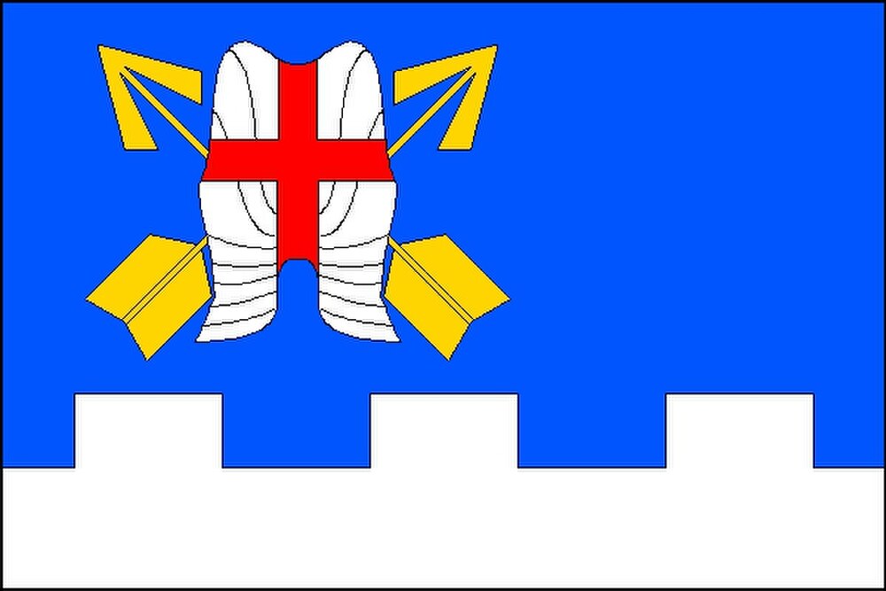
Flag Description: A blue flag with a ratio of 2:3 featuring a white embattled stripe along the bottom edge, with the blue and white fields in a 2:1 proportion. The height of the rectangular embattlements is one-ninth the flag's width and their width is one-sixth the flag's length. In the hoist half of the blue field is a white suit of armour (cuirass with tassets) bearing a red Greek cross, underlaid by two crossed yellow arrows pointing upward.
Symbolism: The cuirass with a red cross and crossed arrows is derived from the coat of arms of the Counts Razumovsky, former lords of the estate who commissioned the local neo-Gothic Church of the Most Holy Saviour. The white embattled stripe evokes the medieval water fortress, and its silver/white colour also represents the Hvozdnice stream flowing through the municipality. The blue and gold tincture combination represents Upper Silesia, whereas silver and red stand for the Opava region.
Statistics
Area
11.26 km²
Population
1,049