Domanín
Digital Passport
Nomenclature and Geography
Category: City / Municipality
Summary
About the place: Domanín is a South Bohemian village and municipality in Jindřichův Hradec District, situated about 4 km southwest of Třeboň in the flat, pond-dotted landscape of the Třeboňsko Protected Landscape Area. Its territory notably encompasses the famous neo-Gothic Schwarzenberg Tomb. (Note: Wikidata ID Q1236824 uniquely identifies this South Bohemian municipality; the South Moravian Domanín in Hodonín District is Q1236817).
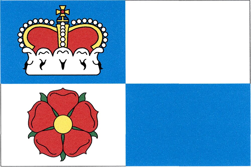
Flag Description: A rectangular flag with an aspect ratio of 2:3, quartered blue and white. In the upper hoist (blue) quarter is a yellow princely crown; in the lower hoist (white) quarter is a red five-petaled rose with a yellow center and green sepals. The upper fly quarter is white and the lower fly quarter is blue, both uncharged.
Symbolism: The flag design (granted on 22 October 2008 by Decision No. 39 of the Chamber of Deputies of the Czech Republic) is derived directly from the municipal coat of arms and honors the two principal noble houses in the village's history. The red five-petaled rose represents the Lords of Rosenberg (Rožmberk), who donated Domanín in 1367 to their newly founded Augustinian monastery in Třeboň. The princely crown and the blue-and-white field represent the Princes of Schwarzenberg, holders of the domain from 1660, who built their ancestral mausoleum here.
Flag Description: A rectangular flag with an aspect ratio of 2:3, quartered blue and white. In the upper hoist (blue) quarter is a yellow princely crown; in the lower hoist (white) quarter is a red five-petaled rose with a yellow center and green sepals. The upper fly quarter is white and the lower fly quarter is blue, both uncharged.
Symbolism: The flag design (granted on 22 October 2008 by Decision No. 39 of the Chamber of Deputies of the Czech Republic) is derived directly from the municipal coat of arms and honors the two principal noble houses in the village's history. The red five-petaled rose represents the Lords of Rosenberg (Rožmberk), who donated Domanín in 1367 to their newly founded Augustinian monastery in Třeboň. The princely crown and the blue-and-white field represent the Princes of Schwarzenberg, holders of the domain from 1660, who built their ancestral mausoleum here.
Statistics
Area
12.43 km²
Population
437