Domašín
Digital Passport
Nomenclature and Geography
Category: City / Municipality
Summary
About the place: Domašín is a rural municipality in Chomutov District within the Ústí nad Labem Region of the Czech Republic, situated on the slopes of the Ore Mountains southwest of Klášterec nad Ohří. It comprises four local parts (Domašín, Louchov, Nová Víska, and Petlery) surrounded by mountain nature and agricultural land.
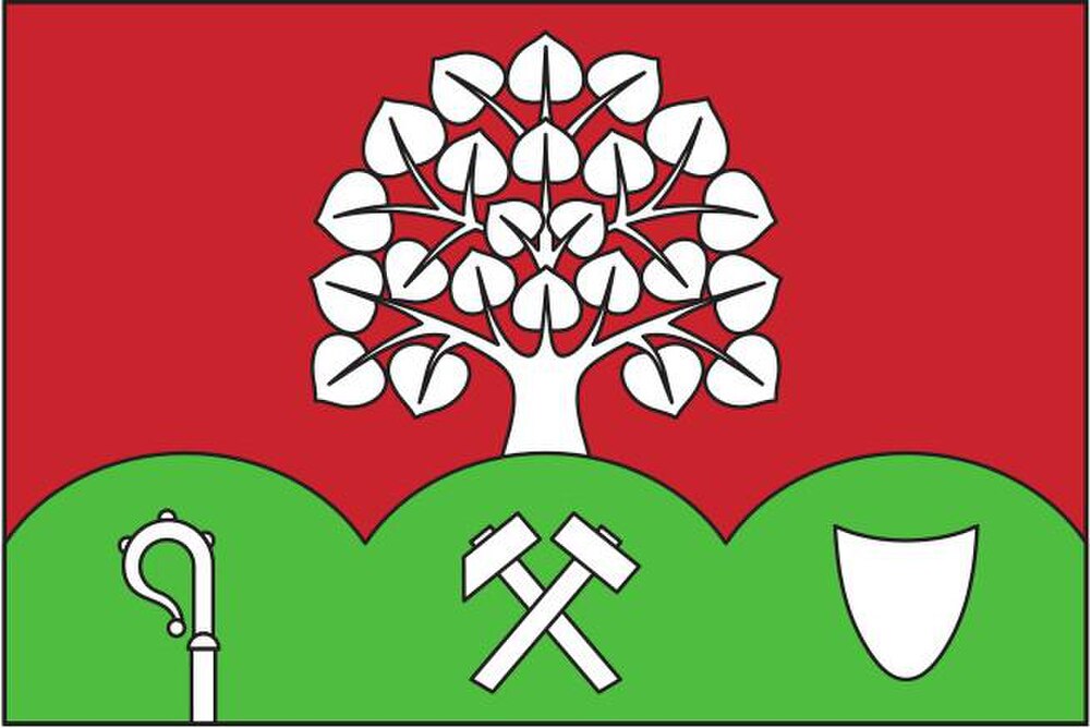
Flag Description: The flag consists of two horizontal stripes in a 3 : 1 width ratio, red and green, divided by an undulating line forming three rounded peaks reaching five-eighths of the flag width. Issuing from the central peak into the red stripe is a white linden tree. In the green stripe, emerging from the bottom edge beneath the three arches, are a white crozier (towards the hoist), white crossed mining hammers (in the center), and a white monastic cowl (towards the fly). The width-to-length ratio of the flag is 2 : 3.
Symbolism: The symbolism derives from the municipal coat of arms designed by Jan Tejkal (granted in 2024). The three green peaks and the linden tree represent the forested, mountainous topography of the Ore Mountains and the Slavic/Czech national tree. The crozier and monastic cowl evoke the historical monastic and ecclesiastical influence in the area (notably associated with the nearby Benedictine provostry in Klášterec nad Ohří), while the crossed miner's hammers commemorate local mining history and ore prospecting in the Ore Mountains.
Statistics
Area
15.80 km²
Population
188