Doňov
Digital Passport
Nomenclature and Geography
Category: City / Municipality
Summary
About the place: Doňov is a small rural municipality in the Jindřichův Hradec District of the South Bohemian Region, Czechia, situated about 6 km northeast of Veselí nad Lužnicí along route I/23. The surrounding landscape has a traditional South Bohemian character featuring rolling farmland and ponds.
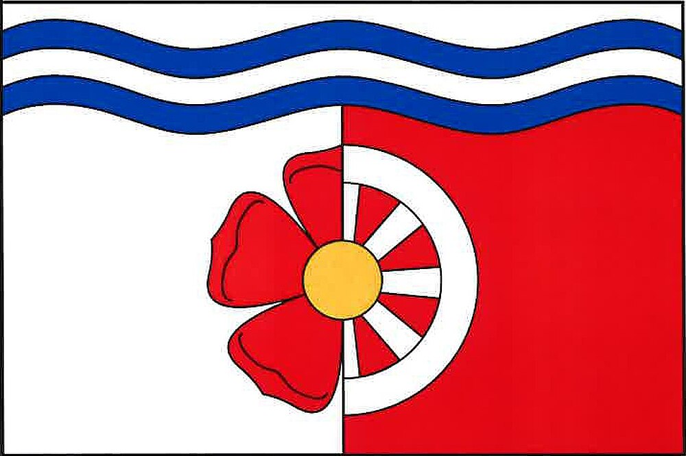
Flag Description: The flag consists of five horizontal stripes: white, wavy blue, wavy white, wavy blue, and an undulated white-red parted stripe, in a width ratio of 1 : 1 : 1 : 1 : 12. In the white field of the bottom stripe, half of a red rose adjoins the parting line, while in the red field lies half of a white cartwheel, sharing a yellow seed (rose centre) in the middle. The ratio of the flag's width to length is 2 : 3.
Symbolism: The red rose represents the historic rule of the Lords of Hradec (branch of the Vítkovci dynasty). The cartwheel symbolizes transportation, local routes, and rural agricultural labor, while the wavy blue and white stripes at the top represent the local streams and ponds characteristic of the South Bohemian landscape.
Statistics
Area
5.13 km²
Population
74