Drahonín
Digital Passport
Nomenclature and Geography
Category: City / Municipality
Summary
About the place: Drahonín is a small rural municipality in the Brno-Country District, South Moravian Region, situated in the forested, undulating landscape of the Křižanov Highlands roughly 11 kilometres northwest of Tišnov.
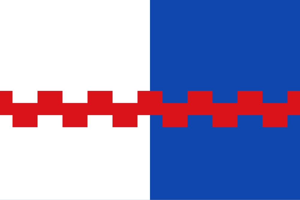
Flag Description: The flag consists of two vertical stripes, white and blue, overlaid by a shifted horizontal red embattled stripe (crenellated on both edges) with a width of one-ninth of the flag's width. The ratio of width to length is 2:3.
Symbolism: The white and blue fields reflect the party per pale division of the municipal coat of arms and local historical traditions. The red horizontal embattled (counter-embattled) stripe symbolizes historic fortified seats in the vicinity, notably the nearby medieval castle ruins of Košíkov and Víckov.
Statistics
Area
6.69 km²
Population
110