Dražíč
Digital Passport
Nomenclature and Geography
Category: City / Municipality
Summary
About the place: Dražíč is a South Bohemian municipality situated in the northern part of the České Budějovice District, near Týn nad Vltavou and Bechyně. It lies in the gently undulating agricultural and forested landscape of the Tábor Uplands.
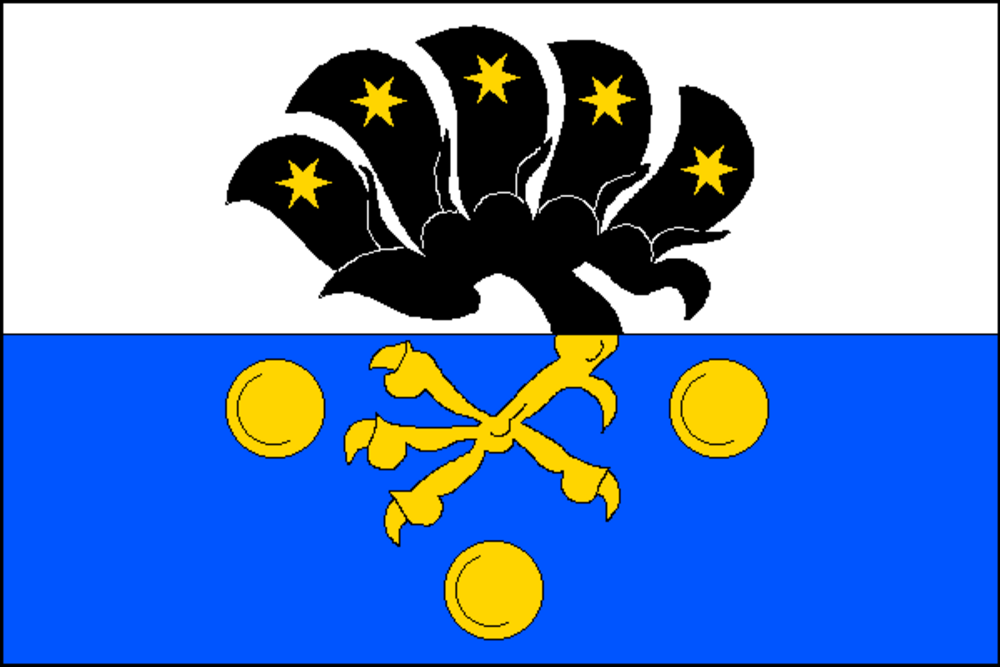
Flag Description: The flag consists of two horizontal stripes, white and blue. Centered is a yellow claw with a black wing of five flight feathers, each bearing a yellow six-pointed star. In the blue stripe, the claw is accompanied below by three (2, 1) yellow roundels. The width-to-length ratio is 2:3.
Symbolism: The black-winged claw on the white and blue field is derived from the historic coat of arms of the Svatkovský of Dobrohošť noble family, who held Dražíč in the 16th and early 17th centuries and erected a Renaissance fortress here. The stars on each flight feather and the three golden roundels (bezants) in the blue field serve as heraldic cadency marks, symbolizing prosperity and the historical settlements forming the municipality.
Statistics
Area
11.35 km²
Population
283