Drozdov
Digital Passport
Nomenclature and Geography
Category: City / Municipality
Summary
About the place: Drozdov is a rural municipality in the Šumperk District of the Olomouc Region, situated in the scenic, forested hills of the Zábřeh Highlands about 7 km west of Zábřeh. It has a tranquil countryside character and includes the popular valley recreational settlement of Drozdovská Pila along the Březná River.
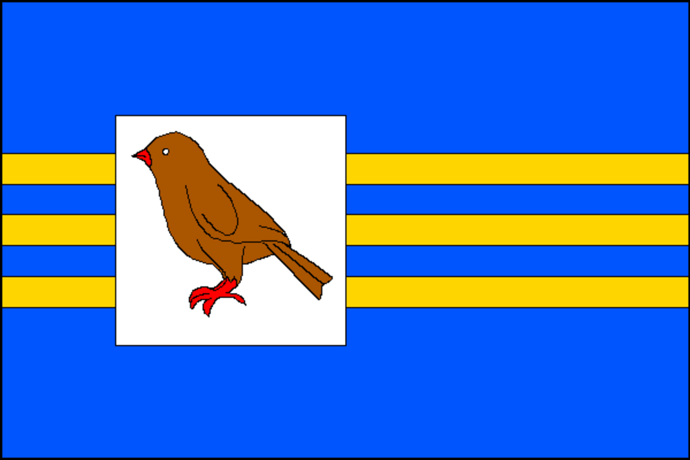
Flag Description: Seven horizontal stripes alternating between blue and yellow in a width ratio of 5:1:1:1:1:1:5. In the second and third sixths of the flag's length, there is a white square field charged with a proper song thrush. The aspect ratio is 2:3.
Symbolism: The thrush is a canting charge directly representing the name of the municipality (Czech 'drozd'). The blue and yellow stripes derive from the primary tinctures of the municipal coat of arms and reference the historical Zábřeh dominion and Moravia, while the broader armorial symbolism (pine trees and crosscut saw) honors the surrounding deep forests and the settlement of Drozdovská Pila with its woodcutting tradition.
Statistics
Area
13.69 km²
Population
355